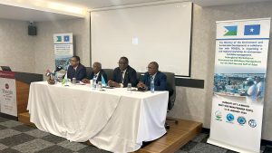
Program overview & vision

Marine Protected Areas (MPAs) are a principal tool for conservation management in the coastal and marine environment. They range from large, zoned, multi-use areas to the more common smaller, usually un-zoned, sites in which all or certain extractive activities are prohibited. MPAs are locations within which certain types of human activity, and particularly fishing, are intended to be regulated more restrictively than they are outside those boundaries. However, the use of MPAs, with notable exceptions, remains unsophisticated in a majority of cases. Also, Marine Protected Areas (MPAs) are established to restore degraded habitats, to allow stock recovery following over-fishing, to protect representative samples of biodiversity (species, habitats, ecosystems), to support fisheries in surrounding areas, and to support social and economic development.
Marine protected areas (MPAs) have been established in many parts of the Red Sea and Gulf of Aden as tools to provide for sustainable resource use, economic development and conservation. Of particular importance is the need to conserve areas that represent the range of the region’s unique habitats and biodiversity and to support national development. This has been initiated through the integration of 12 MPAs from throughout the region into a Regional Network of MPAs for the Red Sea and Gulf of Aden.
Mission and Objectives

- To develop regional capacity in all aspects of MPA planning and management.
- To provide for the sustainable use of living marine resources.
- To support local and national economic and social development.
- To involve local communities and stakeholders as partners in MPA management.
- To conserve representative and prime examples of the biodiversity of the Red Sea and Gulf of Aden.
- To conduct research and monitoring programs for the benefit of MPA management.
- To enhance public awareness of the marine resources and biodiversity of the Red Sea and Gulf of Aden and the principles of sustainable use.
- To protect the unique cultural heritage of the marine and coastal environments of the Red Sea and Gulf of Aden.
- To implement a regional legal framework for protected areas and biodiversity.
Activities and outcomes
- The signing of the Protocol Concerning the Conservation of Biological Diversity and the Establishment of Protected Areas by PERSGA member states in December 2005 was provided a regionally coordinated approach to establishment PERSGA’s MPAs Network. Twelve MPAs were selected for the regional network: Iles des Sept Frères and Ras Siyan (Djibouti); Ras Mohammed National Park; Red Sea North Islands (Egypt); Aqaba Marine Park (Jordan); Straits of Tiran50 Wajh Bank, Sharm Habban and Sharm Munaybirah; Farasan Islands (Saudi Arabia); Aibat and Saad ad-Din Islands, Saba Wanak (Somalia); Sanganeb Marine National Park; Dungonab Bay and Mukkawar Island National Park (Sudan); Socotra Islands; Belhaf and Bir Ali area (Yemen).
- Developed a series of engagements/exchanges between MPA counterparts from one PERSGA member country to another.
- Detailed site assessments were undertaken of many MPAs inside the network.
- Site-Specific Master Plans for four MPAs were implemented
- Regional Master Plan & Survey Design of PERSGA MPAs Network published and disseminated.
- PERSGA prepared and updated the management plan Dungonab Bay-Mukkawar Island National Park in Sudan.
- PERSGA prepared an Integrated Management Plan of the UNESCO World Heritage Site in Sudan (Dungonab Bay and Sanganeeb Atoll).
- Update the zoning plan of Wadi EL-Gemal-Hamata National Park in Egypt.
- Support MPAs network with equipments and management tools .
- Evaluate annually the management effectiveness of the whole MPAs along the Red Sea and Gulf of Aden.
- Published many guidelines about Marine Protected Areas management and planning (Arabic and English).
Gallery
Latest News
National Training Workshop on “Collection and Management of Fisheries Statistics …
PERSGA Concludes National RIMS Training Workshop in Sudan
PERSGA Successfully Conducts National Training Workshop on Regional Information Management …
